To celebrate the culmination of our research into Staverton and the ancient surrounding ritual landscape, we have created a special ‘Solar Sandlings’ walking route that embraces the underlying concepts and sites that we present within this work.
Full details of this route, including downloadable maps and an overview of the sites are available on the excellent British Pilgrimage Trust website. We would like to extend our thanks to the British Pilgrimage Trust for their inspiring work and interest in our research.
Staverton Park
The area known as the Suffolk Sandlings plays host to some of Britain’s rarest wildlife habitat, and home to a deep history and heritage.
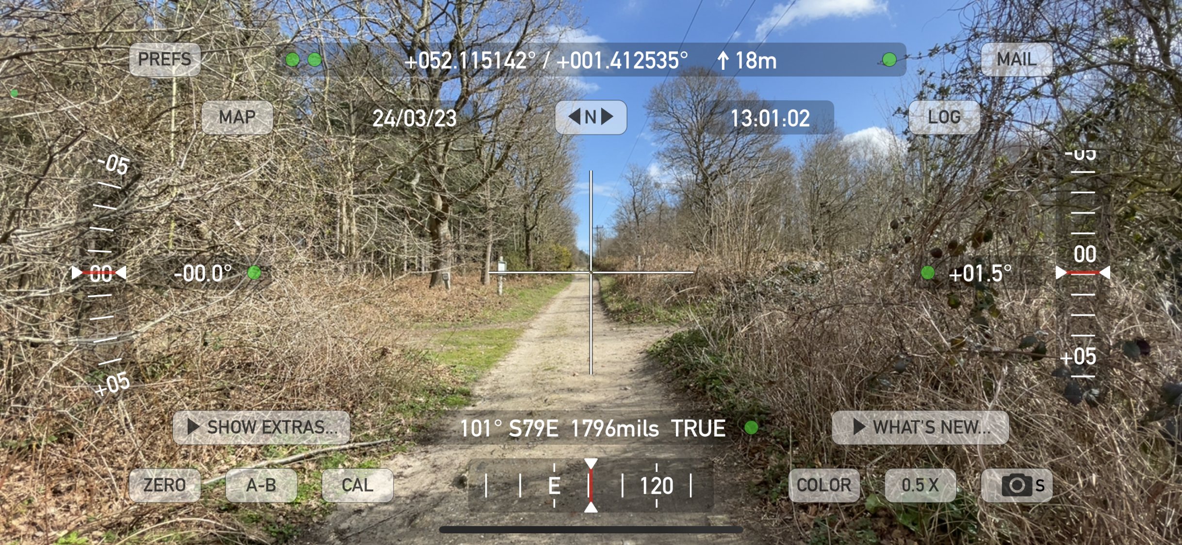
Our 7 mile route is focused on a series of distinct ancient sites proposed by Arcane Landscape Trust researcher Jeremy Taylor, whose work explores how this ritually planned landscape is integrated within systematic sites that were orientated around celestial events. Jeremy’s initial scene setting research on this captivating landscape is available in our ‘Staverton – Wonderland of Kings – Pt 1’ publication. ‘Pt 2 – Skyscapes and landscapes’ (due for release in Summer 2025) highlights how three distinct and ancient sites from the late antique – early medieval period fit within the wider ritual landscape and are all integrated within a designed environment that is oriented around primary and mythological celestial events.
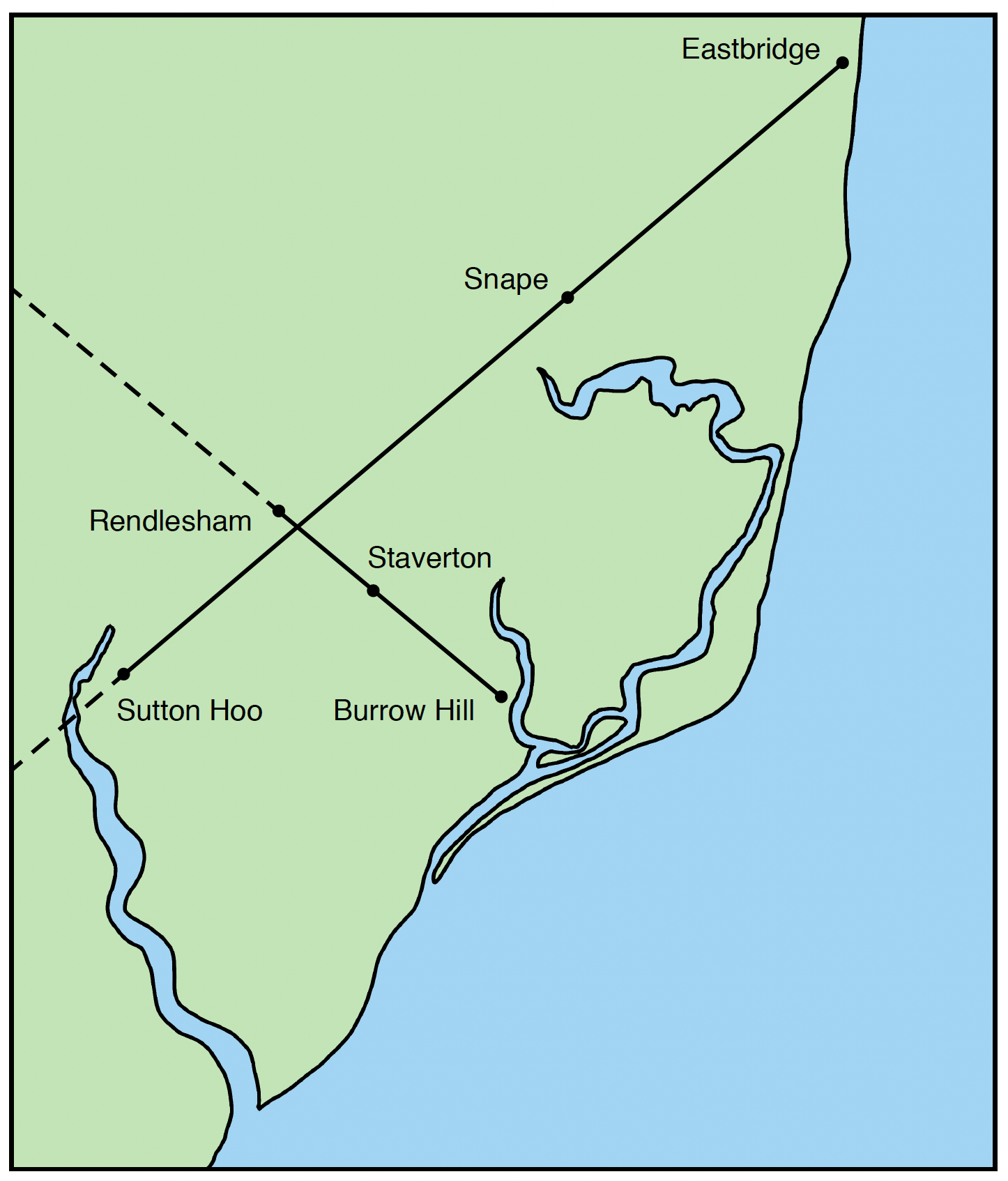
The solar alignments – highlighting the crossing point between Rendlesham, Cumberland’s Mount within Staverton Park and Burrow Hill, with Eastbridge, Snape and Sutton Hoo.
The key locations are positioned on a solar alignment that targets the winter solstice sunrise / summer solstice sunset axis, crossing a larger summer solstice sunrise / winter solstice sunset alignment between the only two known intact ship burials discovered in England. This ‘cross’ in the landscape reflects a profound sacred symbol and tradition, one that repeatedly features in spiritual iconography as well as being fundamental to the construction of ordained ritual landscapes, designed to marry the primary solstitial and cardinal points across the land with the heavens.
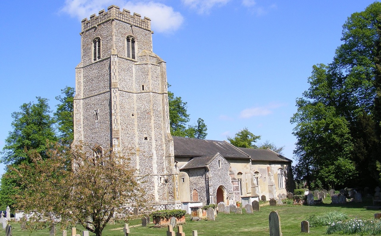
This enchanting and eerily evocative landscape invites us to re-evaluate our understanding of the sites relationship with the more widely known sacred settings of the surrounding Wuffing kingdom in nearby Sutton Hoo, Snape, and Rendlesham, our starting point and home to King Raedwald’s Royal Palace and cult centre.
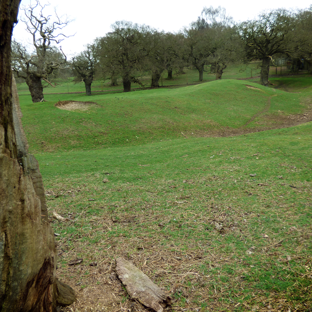
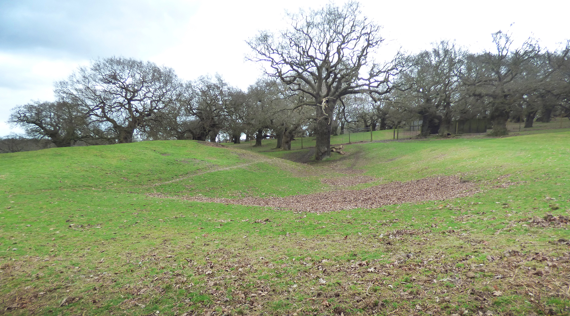
The walk from St. Gregory’s Church in Rendlesham towards Staverton Park, and beyond to Burrow Hill navigates an ancient green lane through the hamlet of Friday Street. This track runs adjacent to the parish boundary and has a procession-like quality leading towards the enigmatic Cumberland’s Mount, a half-moon shaped earthwork of significant magnitude housed within the privately owned Staverton Park.
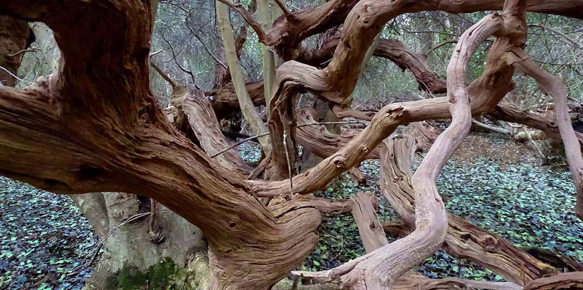
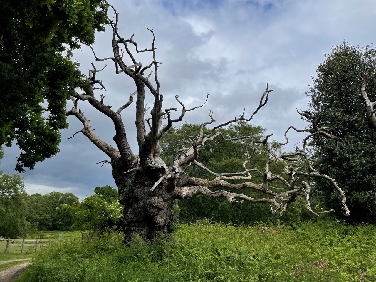
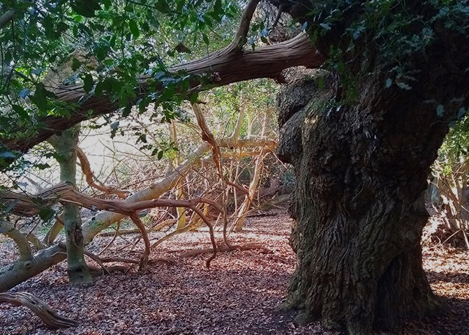
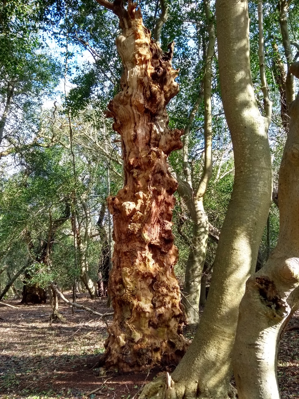
Staverton ParkA ‘phoenix tree’ – a term given to a collapsed tree that has since regenerated.
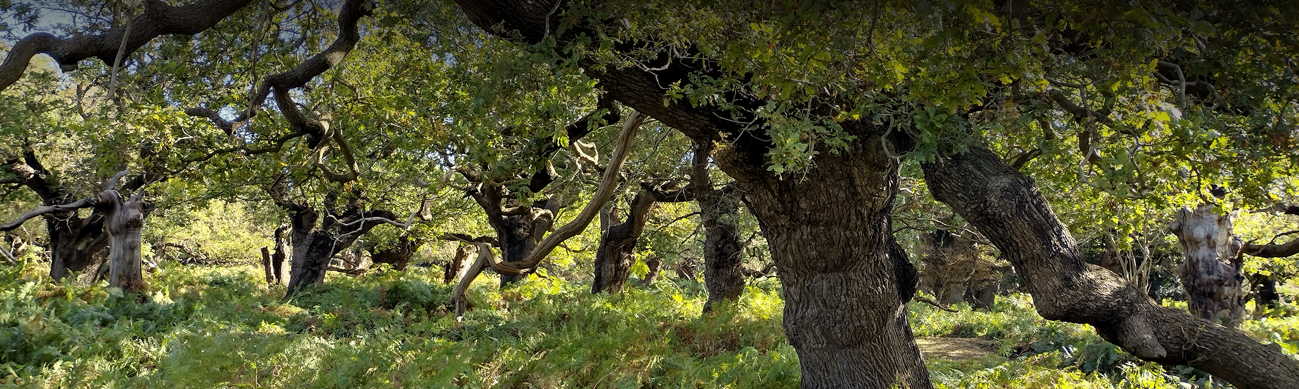
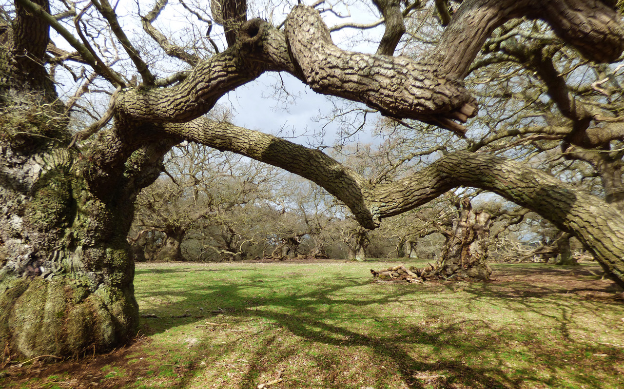
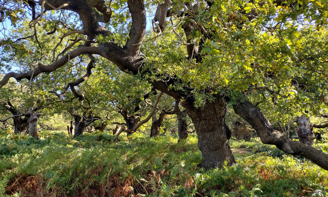
Although the route circumnavigates the park, it is the walks mesmerising centrepiece affording stunning views of this most primordial of forests. Few places on earth touch the soul as deeply as Staverton, be this the mighty contorted oaks in the park itself, home to one of the largest collections of ancient trees in the whole of Europe, or the overwhelming density of the trees in the publicly accessible area known as The Thicks, many of which have regenerated as aptly named ‘phoenix’ trees.
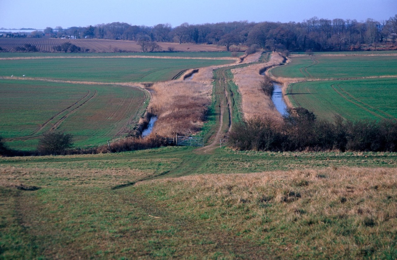
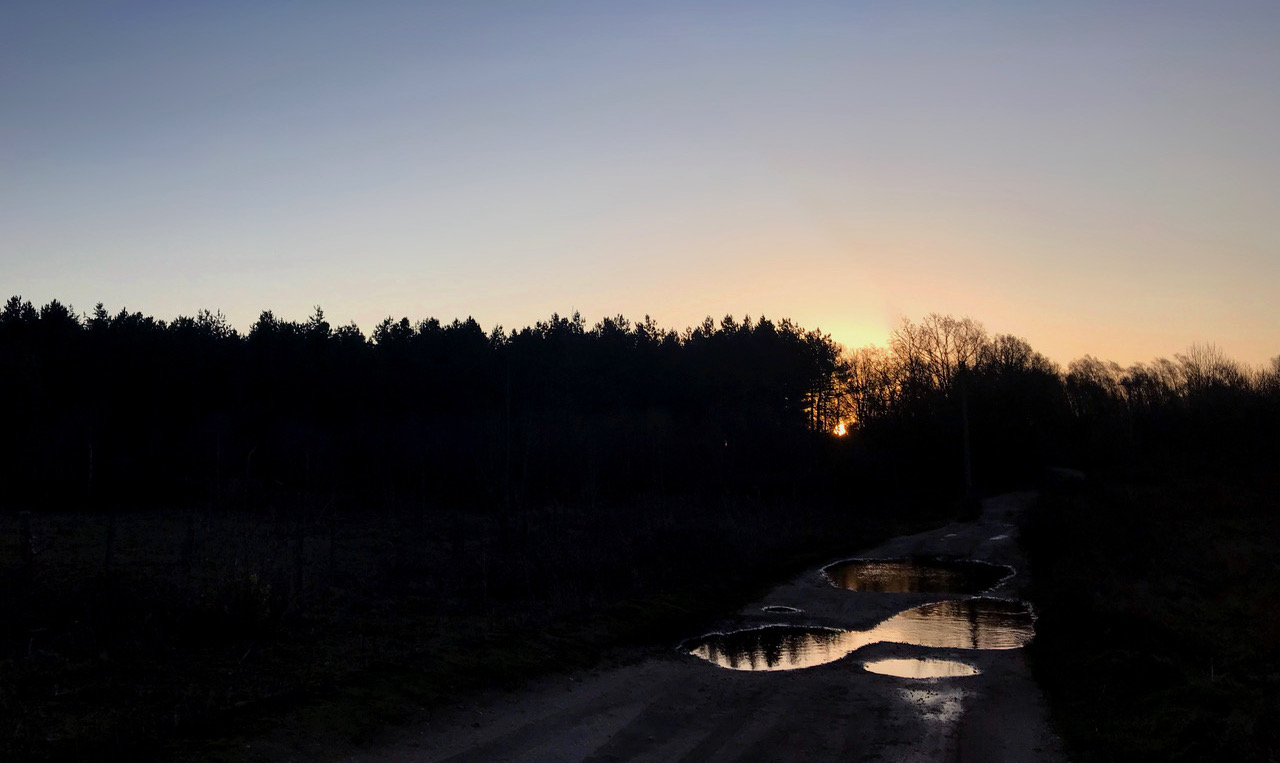
Our walk then gently snakes toward the liminal Burrow Hill, overlooking the mouth of the Butley River via a long earthwork causeway known as The Thrift. Burrow Hill was originally an island minster site and occupied during the Iron Age and Roman times long before the Augustinian priory was founded on the hilltop in the late 12th Century. Due to its close proximity to Rendlesham it is considered a significant Wuffing site.
The Thrift, an ancient causeway across marshland to Burrow Hill.
As well as the site yielding many runic coins, there was also the remains of what are called ‘pseudo-boat burials’, a type of log boat in the form of a bathtub or coffin boat, surrounding the deceased. The practice of placing clinker boat timbers, or substitute planks of boats to either line or cover a grave, mirrors the East Anglian boat-burial tradition found at Snape and Sutton Hoo with a much wider pan-Germanic concept.
This route can be started at either end, but we recommend a starting point of St. Gregory’s Church, Rendlesham, near Woodbridge IP12 2QY, where parking is favourable. Burrow Hill is a symbolic end point before turning around to return.
Nestled amongst the Suffolk Sandlings, Staverton is a bold, otherworldly punctuated verse in the East Anglian sacred landscape.
Staverton is a place of mystery and wonder; it has a peculiar effect on first-time visitors who have no foreknowledge that the world contains such places.
Rackham, O (1986) [1]
PART 1: ITS PLACE IN THE SACRAL LANDSCAPE OF THE SUFFOLK SANDLINGS
Jeremy Taylor
Jeremy’s research and personal experience of this enchanting and eerily evocative landscape invites us to re-evaluate our understanding of the sites relationship with the more widely known sacred settings of the surrounding Wuffing kingdom in nearby Sutton Hoo, Snape and Rendlesham.
As with his previous study ‘A Ritual Landscape Considered’, we hope that Jeremy’s new research shines a light on this richly integrated environment; a landscape like no other, one that resonates so strongly today just as much as it deeply connects us to the ancestors of the Suffolk Sandlings.
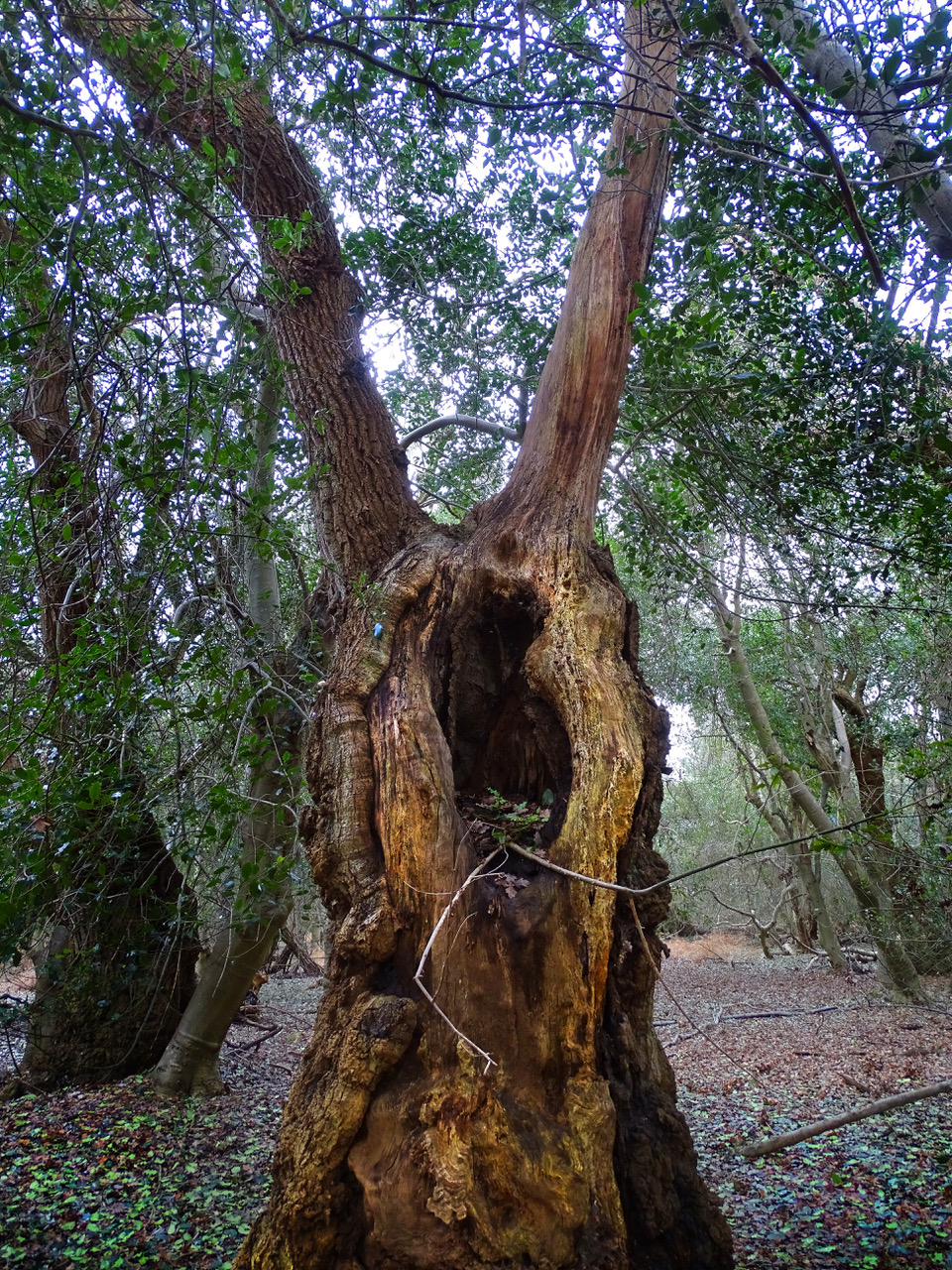
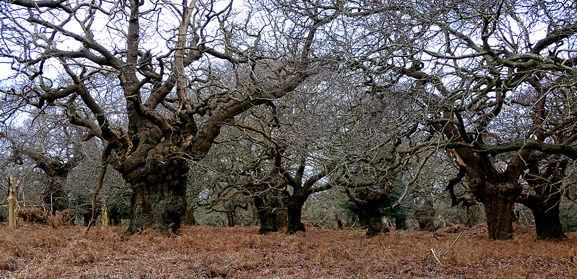
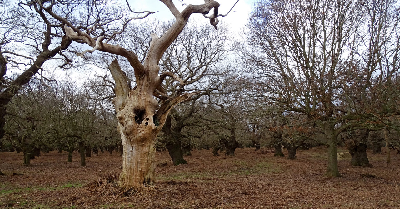
One of Staverton’s 174 standing dead trees.
INTRODUCTION
There is no obvious reason why an extensive woodland “should have survived here when the adjacent heathlands were stripped bare of trees” [2] and Staverton Park, Williamson continues, is “one of the most important surviving areas of wood pasture in England.”
In his seminal book ‘The History of the Countryside’, Oliver Rackham, OBE for services to Nature Conservation, described Staverton Park as “an awesome place of Tolkienesque wonder and beauty. The mighty and bizarre shapes of oaks of unknown age rise out of a sea of tall bracken, or else are mysteriously surrounded by rings of yet mightier hollies.” [3]
Few places on earth touch the soul as deeply as the landscape around Staverton in Suffolk, be this the oaks in the park itself or the myriad of trees in the area known as The Thicks. Not only does it boast some significant statistics, as I will explore, making it ecologically hugely important in Europe, it can lay claim to being held sacred and potentially unspoilt for possibly thousands of years, for the woodlands of The Thicks comes the closest out of all the woodlands in lowland Britain to one that looks wholly natural and unspoilt. [4]
Some of the trees date to at least the 1200’s A.D.* and we know that a woodland did exist in Staverton Manor even earlier according to the Domesday book (1086)[5] while the rest of the surrounding landscape was poorly wooded.[6] The earliest reference to Staverton as a park occurred in 1275, though medieval records dating to 1178 record an increase in stable rent and may indicate imparking, the enclosing of a confined area into a park. [7]
The Bigod family were Earls of Norfolk and early imparkers, having parks recorded at Saxtead by 1140, and Kelsale by 1200, both however in Suffolk. It is entirely possible therefore that an existing well established wooded area was specifically selected and destined to be a deer park in the 12th Century, overlaid on top of the royal activities of Raedwald’s kingdom, for this area being so close to Raedwald’s royal palace who reigned 617 – 625 is considered to be a hunting ground in the early 7th Century.[8] The current parish boundary of the village of Rendlesham is just under 250 metres away which was itself by the early 7th Century virtually the capital of Southern England.[9] Staverton Park is five miles East of Woodbridge and just over four miles from Sutton Hoo, site of the famous Royal Ship burial of Raedwald. Bede**, only 100 years after Raedwald’s death, wrote in his ‘History of the English Church and People’ of a royal residence, a vicus regius called Rendlesham,[10] and where recent findings from archaeological excavations and surveys have been described as some of the most important “in the UK during the early 21st Century.” [11]
The area known as the ‘Suffolk Sandlings’ stretches from the outskirts of Ipswich, north to Southwold, sweeping through the lowland heaths of Sutton and Dunwich, the Forests of Rendlesham and Tunstall before snaking the inland river ways from Butley to Walberswick. Place names ending in Old English ley or leah like Hollesley and Butley indicate substantial amounts of local woodlands and relate to ‘wood’ or ‘clearing.’ [12] This “division between wooded and less wooded parts of England was established in or before the Roman period”. The Suffolk Sandlings play host to some of Britain’s rarest wildlife habitat, and home to a deep history and heritage. The Sandlings are both our natural and cultural heritage which is currently managed as a protected landscape being an area of outstanding natural beauty. Today, the Sandlings represent just 0.8% of the Suffolk landscape at approximately 3,000 hectares, compared with as much as 16,000 hectares less than 250 years ago.[13,14] The proximity to water and the light soils of the Sandlings coastal region favoured early Anglo-Saxon*** activity in these restricted areas, which produced a series of internationally significant high-status cemeteries with boat burials and barrows, including Sutton Hoo and Snape. [16]
It is telling that one interpretation for the origin of the place name Staverton might relate to a post or stake,[16] for in pre-Christian Britain, Stapols were a sacred post, pillar or platform.
In Part 2 of this publication (forthcoming, see below) I will focus on this in greater detail, as well as the wider ritual landscape around Staverton, exploring the cosmological and mythical functions associated with these numinous locations and how they relate to the solstitial surveyed alignment explored in ‘A Ritual Landscape Considered’. [17]
This work will thoroughly explore how three distinct and ancient sites from the late antique – early medieval period fit within the wider ritual landscape and are all integrated within a designed environment that is oriented around primary and mythological celestial events.
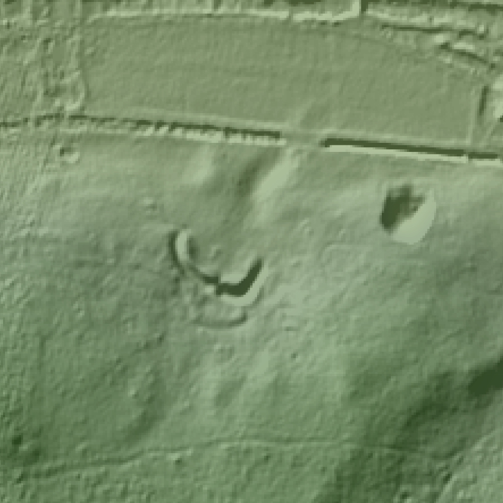
The enigmatic Cumberland’s Mount, Staverton.
We will be looking at Rendlesham, a wholly unique site and the richest longest lived settlement in England of the period. Staverton, one of the most important surviving areas of woodland pasture in England and home to a mysterious earthwork of questionable origin. And Burrow Hill, an island minster site containing pseudo boat burials.
We are now finalising investigations for publication and end our research with an exploration of the enigmatic earthwork Cumberland’s Mount, for bizarrely there is no definitive consensus on exactly what it is. This vast horseshoe shaped earthwork 92 by 85 metres has various attributions, including it being the remains of a timber Castle called a ring work, a red hill – this being a by product of salt production created between the Iron Age to Roman period, or even that it might have been a temporary camp created by insurgents during the peasants revolt in 1381. Ritually planned landscapes used locations chosen for their mythological and cosmological functions, forming part of a wider ensouled landscape.
A winter solstice sunrise and summer solstice sunset alignment passes through the landscape at Staverton, an ancient oak woodland and royal deer park on the periphery of Raedwald’s kingdom. Raedwald was famously buried at Sutton Hoo, and his lavish royal hall at Rendlesham lay on the Northern boundary of the East Saxon territory in the 7th C.
Sitting on the edge of Staverton Park, Cumberland’s Mount was sited in marshland and partly submerged by water for half of the year. It would have been approached from Friday Street, an ancient green road that we believe was once a processional routeway.
Along with Burrow Hill at the mouth of the Butley River, also a marshland location and originally an island site, these sites echoed notions of a pre-Christian Nordic cosmos, where a tree, world pillar or post was surrounded by water.
Solar Sandlings Walk
To celebrate the culmination of our research into Staverton and the ancient surrounding ritual landscape, we have created a special walking route that embraces the underlying concepts and sites that we present within this work. Full details of this route, including downloadable maps and an overview of the sites are available on the excellent British Pilgrimage Trust website. We would like to extend our thanks to the British Pilgrimage Trust for their inspiring work and interest in our research.
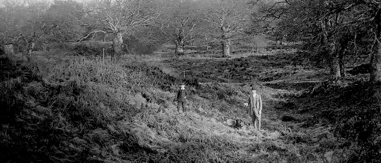
Cumberland’s Mount. The vallum and foss from western outer bank looking in an E.S.E direction. Showing entrance way on the southern side dividing the ditch. Excavated Easter 1910. Gamekeeper and son. Photograph by Mr. H. St. George Gray. JA3/12/2. Source: Suffolk Archives
Footnotes
* Unless stated otherwise or unless quoting from source material, all other dates used from here will be A.D.
** An English monk (673-735) Saint Bede or the Venerable Bede was also an author and scholar often referred to as the father of English history.
*** In the section, ‘The people of the Suffolk Sandlings: royal rule, kingdom and beliefs’, I will explore why this term currently is often challenged.
References
Rackham, O (1986) The History of the Countryside: The Classic History of Britain’s landscape, flora and fauna
Williamson, T (2005) Sandlands: The Suffolk Coast and Heaths. Windgather Press. Macclesfield
Rackham, O (1986) The History of the Countryside: The Classic History of Britain’s landscape, flora and fauna. Phoenix Press. London
Peterken, G.F (1969) Development of Vegetation in Staverton Park, Suffolk. Field Studies 3.
Battell, G., Hoppitt, R. & Martin, E., (2007) ‘Staverton Park’, Proceedings of the Suffolk Institute of Archaeology and History vol. XLI pt. 3.
Darby, H.C (1952) The Domesday geography of Eastern England. C.U.P. Cambridge
Peterken, G.F (1969) (Ibid)
Williamson, T (2005) (Ibid)
Clarke, R.R (1960) East Anglia. Thames & Hudson. London
Bruce-Mitford, R. L. S (1948) Saxon Rendlesham: Some preliminary considerations. Proceedings of the Suffolk Institute of Archaeology. Ipswich. XXIV (3)
Anglo-Saxon Palace at Rendlesham (2016) University of Suffolk
Rackham, O (2006) Woodlands. Harper Collins. London
Heathland Restoration in the Suffolk Sandlings. Environmental Statement for Suffolk Coastal District Council. The Landscape Partnership. (2012)
Beardall, C & Casey, D (1995) Suffolk’s Changing Countryside. Wildlife habitats and their conservation in Suffolk. Suffolk Wildlife Trust.
Peterken, G.F (1969) (Ibid)
Briggs, K (2015) Suffolk place-names: elements and personal names.
Taylor, J & Taylor, M (2019) A Ritual Landscape Considered: Cosmography and Anglo Saxon ship burials.
We are currently writing and researching a series of new works for future publication. Keep your eyes peeled for updates.
Staverton – Part 2: Landscapes and Skyscapes
This work will thoroughly explore how three distinct and ancient landscapes from the late antique – early medieval period fit within the wider ritual landscape and are all integrated within a designed landscape that is oriented around primary and mythological celestial events. We will be looking at Rendlesham, a wholly unique site and the richest longest lived settlement in England of the period. Staverton, one of the most important surviving areas of woodland pasture in England and home to a mysterious earthwork of questionable origin. And Burrow Hill, an island minster site containing pseudo boat burials.
The Black Ditches at Risby and Cavenham in Suffolk are the most easterly of 5 such dykes and ditches that stretch out across Suffolk and Cambridgeshire. The Black Ditches are believed to have been up to a staggering 4.5 miles in length, yet their origin, date and purpose remains somewhat unclear. Described as either Roman sewers or more typically as being built in the late 6th century as a defensive measure against invasion and designed to protect the ancient Icknield Way, a key line of communication and transport at the time. However, this standard military and defensive interpretation for many such ancient linear earthworks is now being called into question. New research suggests that these linear monuments are far older, potenitially early Iron Age, and formed part of a ritual landscape that was dotted along their course with sacred sites, springs, burial mounds and temples, often having heath and woodland at their southern ends with springs and votive offering sites at their northern point.
Roman Forts and Shrines were typically designed on a standardised rectangular form along the empire’s frontier across much of Great Britain. However, we know that there were unusual geometric exceptions to this. We will explore the design exceptions to this, paying close attention to the square Fort of Hardknott in Cumbria that was oriented to the sunrise and sunset on the summer and winter solstices, the triple ditched rhombus shaped Fort at Pakenham in Suffolk, the hexagonal Shrine near Winchester in Hampshire, and the decahexagonal / sixteen-sided polygonal Temple at Silchester, also in Hampshire.
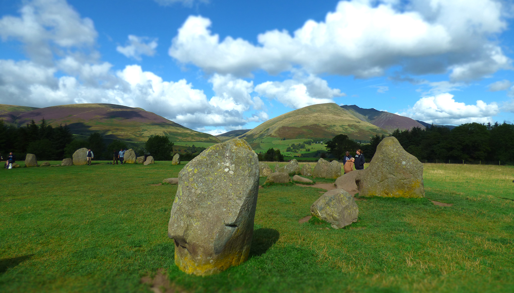
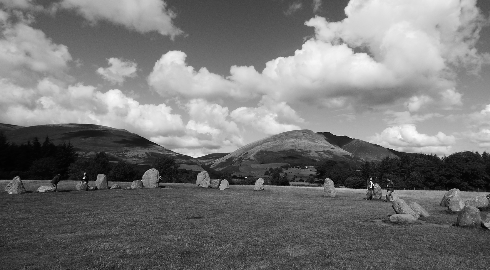
Castlerigg Stone Circle set in the Lake District in Keswick is generally considered to have been raised in about 3000 BC, 5000 years ago during the Neolithic period. According to recent archaeological analysis, new findings indicate that its first phase of construction may be far older and predate Stonehenge, approximately 3100 BC by as much as 600 years. Part of the circle, known as the ‘Sanctuary’ replicates in stone many smaller rectangular Neolithic structures in Ireland and Yorkshire. These were built with timber and used from around 5700 to 5600 years ago. We will explore how this transitional phase of ritual architecture developed and transformed over the centuries and across the country.
Far away from the mind boggling complexity of the pyramids of Giza, yet equally compelling, sit seven sites of mythic antiquity whose geomantic and geometric design collectively creates a beautiful and vast heptagon in the landscape. The distances between the locations and the dimension of this symbol has been faithfully duplicated at other locations in Southern Britain, consciously created and designed to personify a harmonious fusion between temple proportion, the Earth’s circumference and ancient units of measure.
I was seduced into reading it. It’s wealth of antiquarian detail is woven around a core of mystical knowledge.
John Michell
FORWARD – BY DAVID FURLONG
Making sense of the faint echoes from an ancient culture is a slow and painstaking task, relying as much on intuition as hard factual evidence. We all know of great monuments like Stonehenge and Avebury but what sort of people built these amazing edifices and what other secrets might they have woven into the landscape? In today’s culture we link our cities by road, rail and electricity grid networks. Perhaps our ancestors had the same idea but from a slightly different perspective.
In this study on the Suffolk landscape Jeremy Taylor has spent long hours researching obscured landscape traces that reach back in time more than four thousand years. His discoveries point to a connection with the landscape that can be expressed in geometric terms. Simple geometry discovered by a peg, stick marker and a length of string, scratched into the dirt on the ground, must have seemed a magical operation to an ancient people. Perhaps it was a way of understanding the two great astronomical bodies in the sky – the sun and the moon and the attendant patterns of the night time sky – perhaps it was just a fascination with the way that lines, circles and number could be combined. Whatever the impulse what we do know is that megalithic man built huge structures that reflected this symbolism. It is not too much of a jump to postulate that he/she might have wanted to express these same principles on a macrocosmic scale in their landscape, perhaps as a way of creating a ritual space in which to reside.
My own researches on the Marlborough Downs in Wiltshire, set out in my book The Keys to the Temple, showed the amazing skills of the Neolithic people in surveying and setting out a vast twin circle pattern in the landscape. To have done this they would have to have had a high level of numeracy and the ability to work with accurate measurements. In this work Jeremy Taylor shows another such pattern set out in the landscape of Suffolk creating, in this case, a seven pointed star, centred on the great abbey of Bury St Edmunds. We may wonder at the ingenuity of our ancestors who perceived their landscape as a ritual place, perhaps holding ceremonies at significant points in the pattern on key dates in the year.
This is a well researched book which adds to our perception and understanding of the peoples who inhabited our lands millennia ago and I would commend it to the reader.
In this fresh new study following ten years of research, the authors propose that there is evidence of sophisticated geo-ritual surveying in the landscape, that connects the primary Anglo-Saxon boat burials at Sutton Hoo and Snape with the Summer and Winter Solstices. Corroborated by high precision custom mapping software from an Emeritus Professor in Architecture and supported by independent analysis from the Sohland Observatory and its Section on Archaeoastronomy in Germany, read how the movements of the sun become a template for cosmic and Royal order. With over 90 illustrations and around 52,000 words the authors findings explain why the boat burials occurred in the landscape, exactly where they were.
If all of this sounds far fetched, the authors discovered that there have been published studies in 1933, 1950 and 2015 on the East Anglian landscape that describe an elaborate network of solar alignments in relation to the planning and orientation of ancient sites. Described as archaic observation posts and bearing lines, they relate to the Summer Solstice and Winter Solstice sun, and are a part of the hidden landscape of East Anglia. More recently in 2015, a well publicised book described Ptolemy’s map of the British Isles in 150 A.D. based on lines of latitude and longitude, mapped across the whole of southern Britannia by using a Pythagorean 3-4-5 triangle. Radiating out from the Ompahlos centre at Oxford, Summer Solstice and Winter Solstice bearing lines were used to map the whole of southern Britannia with spectacular success. A solstice bearing of 51.35 degrees from the map’s centre at Londinium travels from Westminster Abbey, through Colchester before passing through Sutton Hoo.
This study draws on the latest research from across the globe, showing how boat burials, tumuli, stone ship settings and ceremonial roads across Europe from 750 B.C. – 1000 A.D. were meticulously constructed so as to conform to specific celestial and solar astronomical events. Long distance alignments from between 4 km – 63 Km in Sweden target the Summer and Winter Solstice sunrise and sunset. Such monuments were built to influence the way people experienced the landscape and how they were configured served to structure the ways that people understood both space and time. We explore the practice of East-West axial alignment, now considered to be one of the features of high status Anglo-Saxon settlements, which included non-architectural features such as wells, crosses, cemeteries and old ritual sites built on the Anglo-Saxon Kingship tradition. Linking the themes of day and night to the full span of a king’s rule, the movement of the sun was linked to maintaining cosmic Royal order to a seasonal yearly division meant to legitimise a king’s ritual role in seasonal regeneration. At the apex of Proto-Indo-European society, the title associated with kingly rule has at its root concepts of doing the right thing, straightness, correctness, goodness, sovereign kingly rule and even “movement along a straight line” for the core meaning of reg, as in regal.
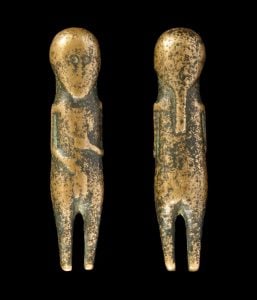
Discover how rare talismanic three dimensional human figurines dating from 400-750 A.D. spanning the Anglo-Saxon conversion period, relate to the solar alignment across this ensoulled landscape. Only eight examples are known to occur across Suffolk’s 1,467 square miles. Their distribution tracks the eastern coastal zone of East Anglia and it is of note that three of these are at locations on our proposed solstice alignment.
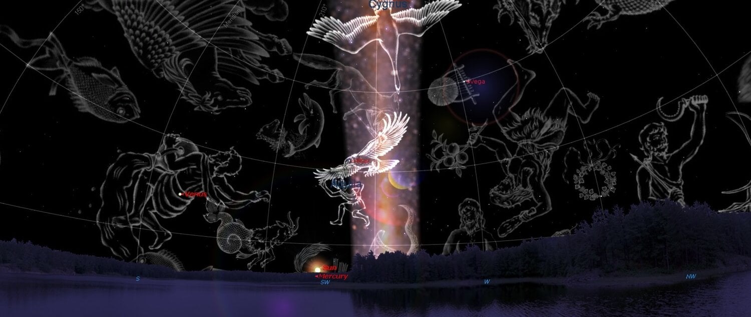
In myth, Odin arranged the periods of daylight and darkness, placing the sun and moon in the heavens and the establishment of the solar path. He also transforms into both an eagle, a serpent and the Milky Way, which has been described as polysemous, resembling both a river when it hugs the horizon or a tree when it extends vertically, attracting serpents and birds in its tree aspect. The two points where the ecliptic, the band of stars that contain the zodiac constellations and the Milky Way cross are the constellations of Gemini (divine twins helping the sun in transformation at sunrise and sunset) and Scorpio. These symbols of solstice duality involved birds (Summer Solstice/Gemini) and serpents (Winter Solstice/Scorpio) and that it was at these heavenly gates, where the Milky Way and the band of constellations crossed; these crossroads were believed to be where the descent and ascent of souls occurred. In many Indo-European societies, the myth of the warrior-god who must restore the harmonious balance over nature by restoring order over chaos was re-enacted at the Winter Solstice.
The sky at the winter solstice sunset 625 AD at Sutton Hoo. Mercury/Woden setting beside the sun with the milky way in tree aspect.
Boat burials were an attempt to align the local elite with the ritual-cosmology of the Scandinavians and the boat, which like its masculine counterpart, the serpent, also stood for regeneration and both symbols are enshrined in the mythic grave goods at Sutton Hoo.
The place below the horizon where the sun disappeared to and rose from was the underworld and was important in the cosmological sense: being the abode of the gods.
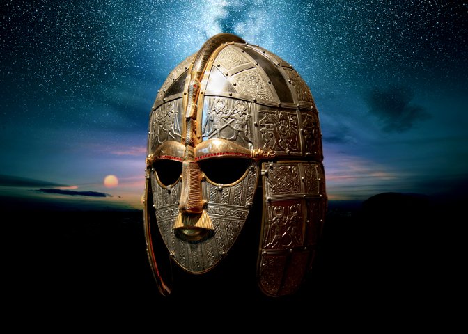
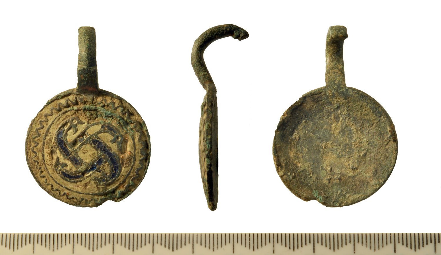
Raedwald, Anglo-Saxon king buried at Sutton Hoo was the binding link between earth and sky, upper and lower worlds. The Summer Solstice rising sun and Winter Solstice setting sun symbolically mirrored ideas of kingly rule, order, liminality, transformation, death and renewal. Is this why the ancient solar symbol of the swastika occurs on the grave goods at least fives times at Sutton Hoo, Snape and Rendlesham, home to Raedwald’s Anglo-Saxon palace and cult centre?
With ‘A Ritual Landscape Considered’ the authors have created a comprehensive and highly important study concerning the celestial astronomy and cosmological backgrounds behind the funerary practices of the Vikings and Anglo-Saxons, particularly those who came to settle in Eastern Britain from the fifth century onwards. Yet it is far more than this, for they demonstrate the roots and origins of humanity’s rigid adherence not only of the movements of the sun and moon, but also of the stars, constellations and Milky Way. All of these themes come together in the design, layout and orientation of ancient ceremonial and ritual centers built across Europe prior to the emergence of Roman Christianity. A must read for any student of ancient astronomies, including those, like me, with a keen interest in the constellation of Cygnus, the celestial swan, which has a major role in this ancient saga.
Andrew Collins, Best selling author and researcher
 It is telling that one interpretation for the origin of the place name Staverton might relate to a post or stake,[16] for in pre-Christian Britain, Stapols were a sacred post, pillar or platform.