Staverton – Pt1: Wonderland of Kings
Nestled amongst the Suffolk Sandlings, Staverton is a bold, otherworldly punctuated verse in the East Anglian sacred landscape.
Staverton is a place of mystery and wonder; it has a peculiar effect on first-time visitors who have no foreknowledge that the world contains such places.
ITS PLACE IN THE SACRAL LANDSCAPE OF THE SUFFOLK SANDLINGS
Jeremy Taylor
Jeremy’s research and personal experience of this enchanting and eerily evocative landscape invites us to re-evaluate our understanding of the sites relationship with the more widely known sacred settings of the surrounding Wuffing kingdom in nearby Sutton Hoo, Snape and Rendlesham.
As with his previous study ‘A Ritual Landscape Considered’, we hope that Jeremy’s new research shines a light on this richly integrated environment; a landscape like no other, one that resonates so strongly today just as much as it deeply connects us to the ancestors of the Suffolk Sandlings.
INTRODUCTION
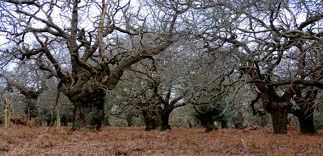
There is no obvious reason why an extensive woodland “should have survived here when the adjacent heathlands were stripped bare of trees” [2] and Staverton Park, Williamson continues, is “one of the most important surviving areas of wood pasture in England.”
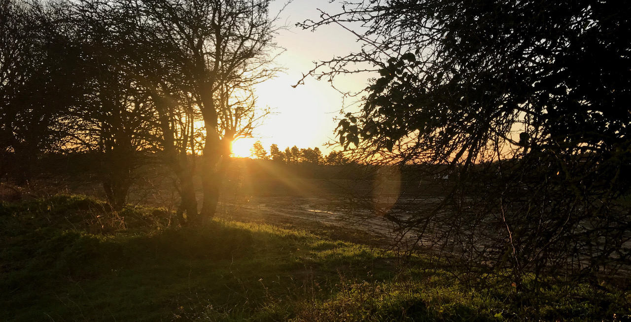
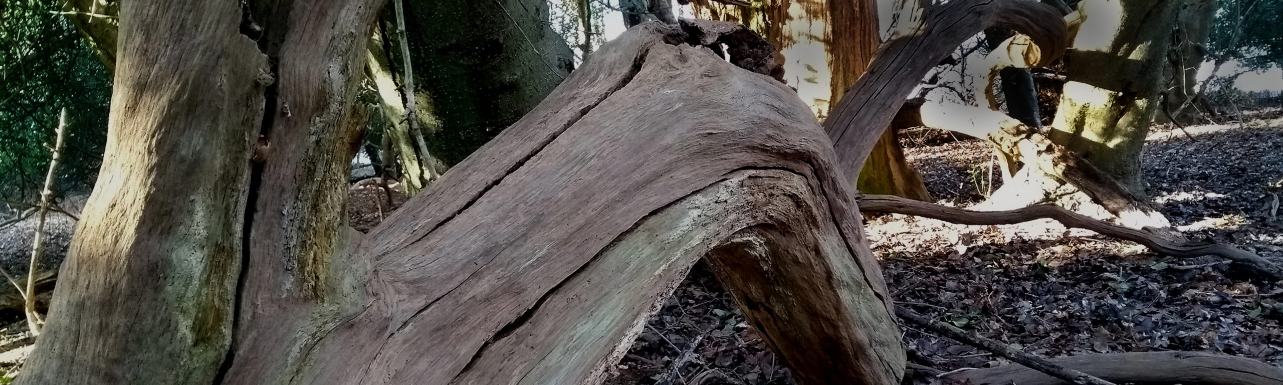
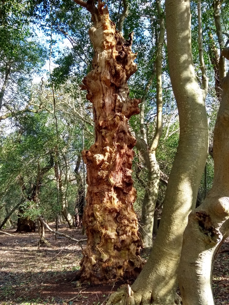
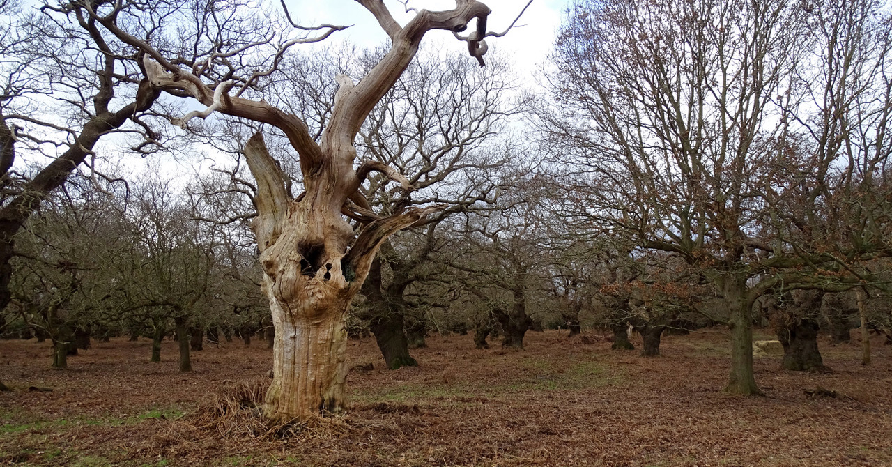
In his seminal book ‘The History of the Countryside’, Oliver Rackham, OBE for services to Nature Conservation, described Staverton Park as “an awesome place of Tolkienesque wonder and beauty. The mighty and bizarre shapes of oaks of unknown age rise out of a sea of tall bracken, or else are mysteriously surrounded by rings of yet mightier hollies.” [3]
Few places on earth touch the soul as deeply as the landscape around Staverton in Suffolk, be this the oaks in the park itself or the myriad of trees in the area known as The Thicks. Not only does it boast some significant statistics, as I will explore, making it ecologically hugely important in Europe, it can lay claim to being held sacred and potentially unspoilt for possibly thousands of years, for the woodlands of The Thicks comes the closest out of all the woodlands in lowland Britain to one that looks wholly natural and unspoilt. [4]
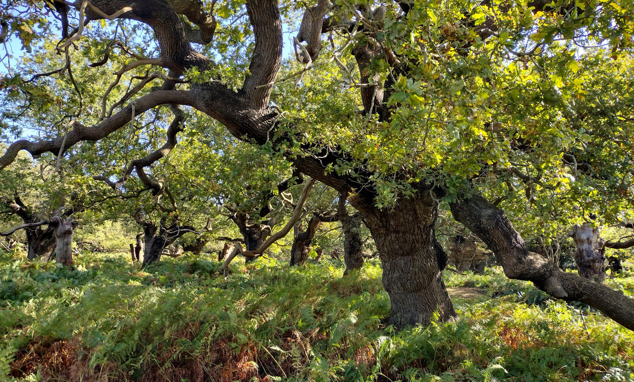
Some of the trees date to at least the 1200’s A.D.* and we know that a woodland did exist in Staverton Manor even earlier according to the Domesday book (1086)[5] while the rest of the surrounding landscape was poorly wooded.[6] The earliest reference to Staverton as a park occurred in 1275, though medieval records dating to 1178 record an increase in stable rent and may indicate imparking, the enclosing of a confined area into a park. [7]
The Bigod family were Earls of Norfolk and early imparkers, having parks recorded at Saxtead by 1140, and Kelsale by 1200, both however in Suffolk. It is entirely possible therefore that an existing well established wooded area was specifically selected and destined to be a deer park in the 12th Century, overlaid on top of the royal activities of Raedwald’s kingdom, for this area being so close to Raedwald’s royal palace who reigned 617 – 625 is considered to be a hunting ground in the early 7th Century.[8] The current parish boundary of the village of Rendlesham is just under 250 metres away which was itself by the early 7th Century virtually the capital of Southern England.[9] Staverton Park is five miles East of Woodbridge and just over four miles from Sutton Hoo, site of the famous Royal Ship burial of Raedwald. Bede**, only 100 years after Raedwald’s death, wrote in his ‘History of the English Church and People’ of a royal residence, a vicus regius called Rendlesham,[10] and where recent findings from archaeological excavations and surveys have been described as some of the most important “in the UK during the early 21st Century.” [11]
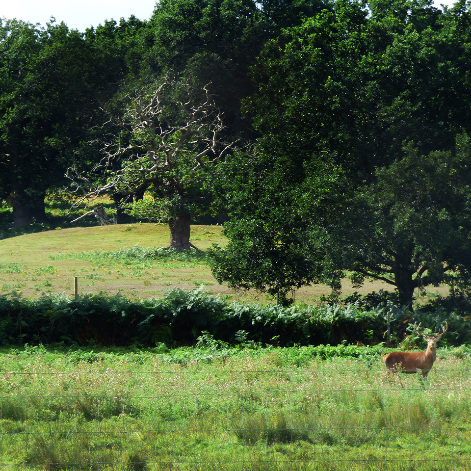
The area known as the ‘Suffolk Sandlings’ stretches from the outskirts of Ipswich, north to Southwold, sweeping through the lowland heaths of Sutton and Dunwich, the Forests of Rendlesham and Tunstall before snaking the inland river ways from Butley to Walberswick. Place names ending in Old English ley or leah like Hollesley and Butley indicate substantial amounts of local woodlands and relate to ‘wood’ or ‘clearing.’ [12] This “division between wooded and less wooded parts of England was established in or before the Roman period”. The Suffolk Sandlings play host to some of Britain’s rarest wildlife habitat, and home to a deep history and heritage. The Sandlings are both our natural and cultural heritage which is currently managed as a protected landscape being an area of outstanding natural beauty. Today, the Sandlings represent just 0.8% of the Suffolk landscape at approximately 3,000 hectares, compared with as much as 16,000 hectares less than 250 years ago.[13,14] The proximity to water and the light soils of the Sandlings coastal region favoured early Anglo-Saxon*** activity in these restricted areas, which produced a series of internationally significant high-status cemeteries with boat burials and barrows, including Sutton Hoo and Snape. [16]
 It is telling that one interpretation for the origin of the place name Staverton might relate to a post or stake,[16] for in pre-Christian Britain, Stapols were a sacred post, pillar or platform.
In Part 2 of this publication (forthcoming, see below) I will focus on this in greater detail, as well as the wider ritual landscape around Staverton, exploring the cosmological and mythical functions associated with these numinous locations and how they relate to the solstitial surveyed alignment explored in ‘A Ritual Landscape Considered’. [17]
To dig deeper into this enchanting ancient landscape, download our full publication for free.
Download > Staverton – Pt1: Wonderland of Kings
Forthcoming: Part 2 – Landscapes & Skyscapes – Forgotten realms of the Suffolk Sandlings
This work will thoroughly explore how three distinct and ancient sites from the late antique – early medieval period fit within the wider ritual landscape and are all integrated within a designed environment that is oriented around primary and mythological celestial events.
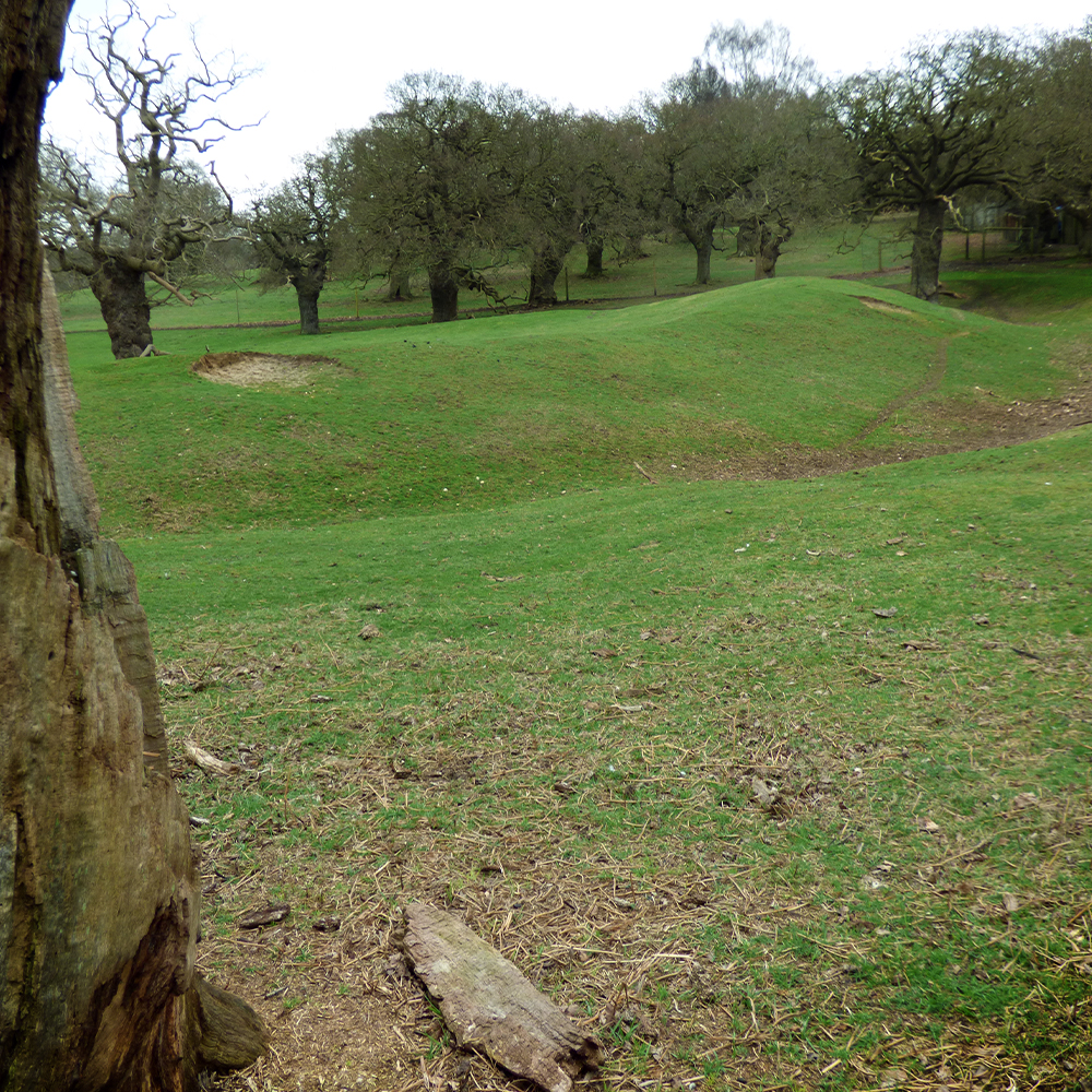
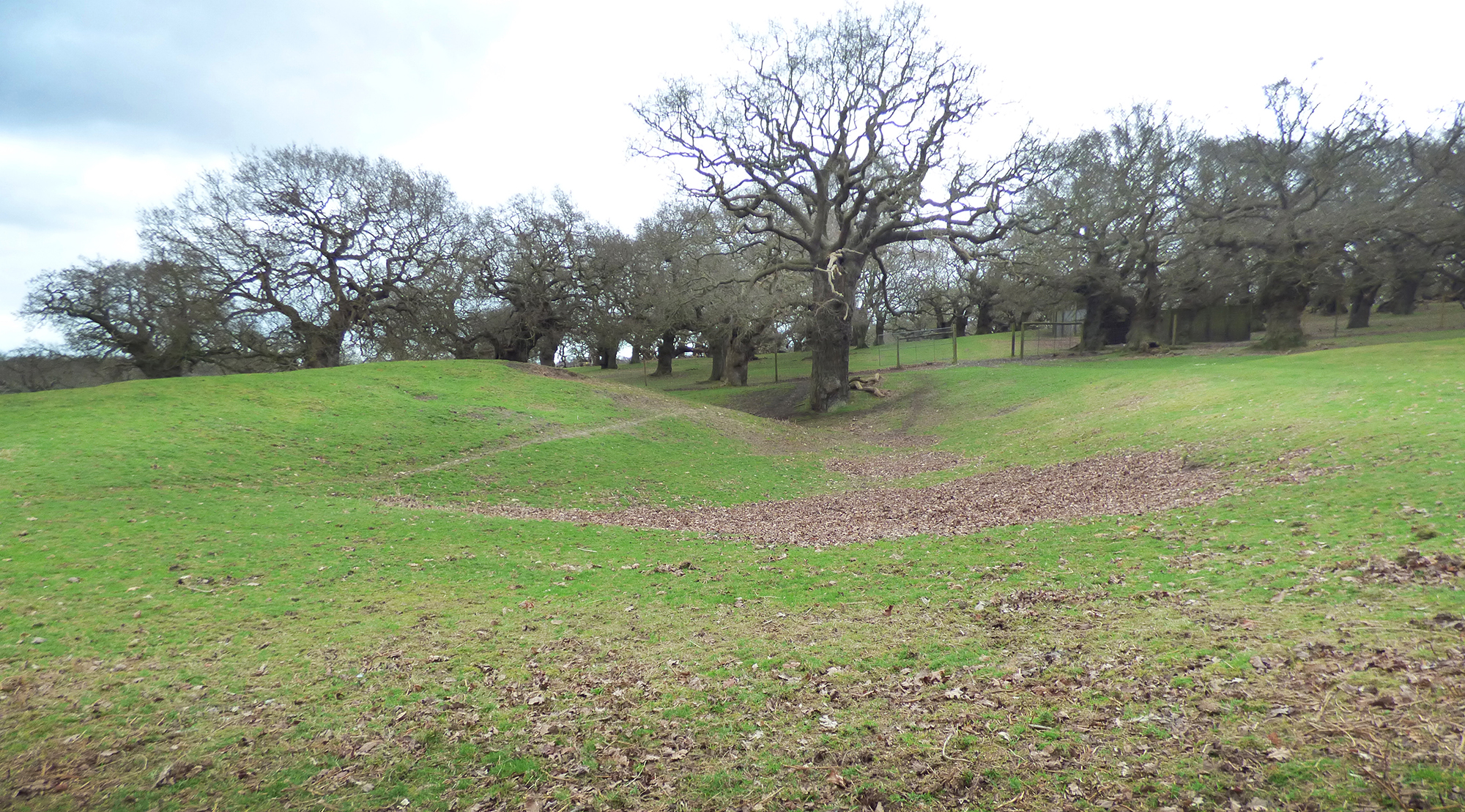
We will be looking at Rendlesham, a wholly unique site and the richest longest lived settlement in England of the period. Staverton, one of the most important surviving areas of woodland pasture in England and home to a mysterious earthwork of questionable origin. And Burrow Hill, an island minster site containing pseudo boat burials.
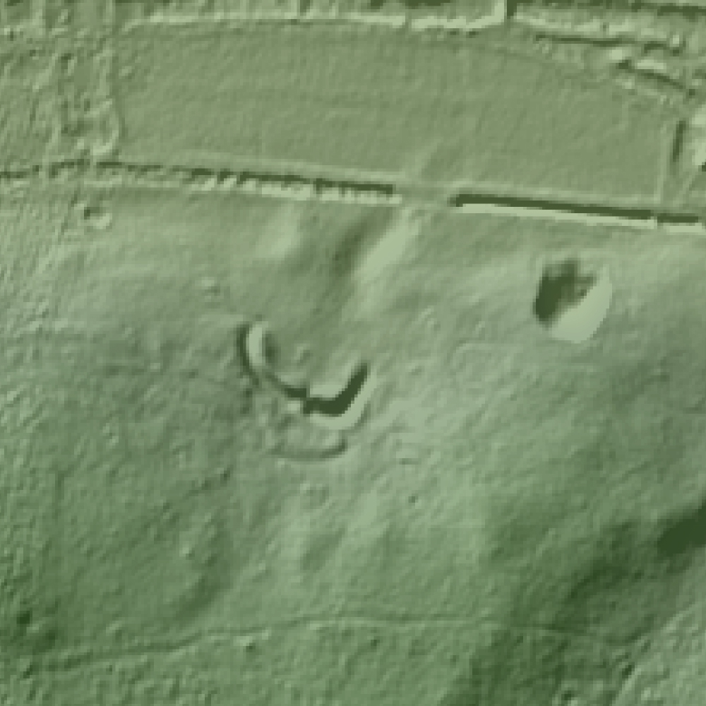
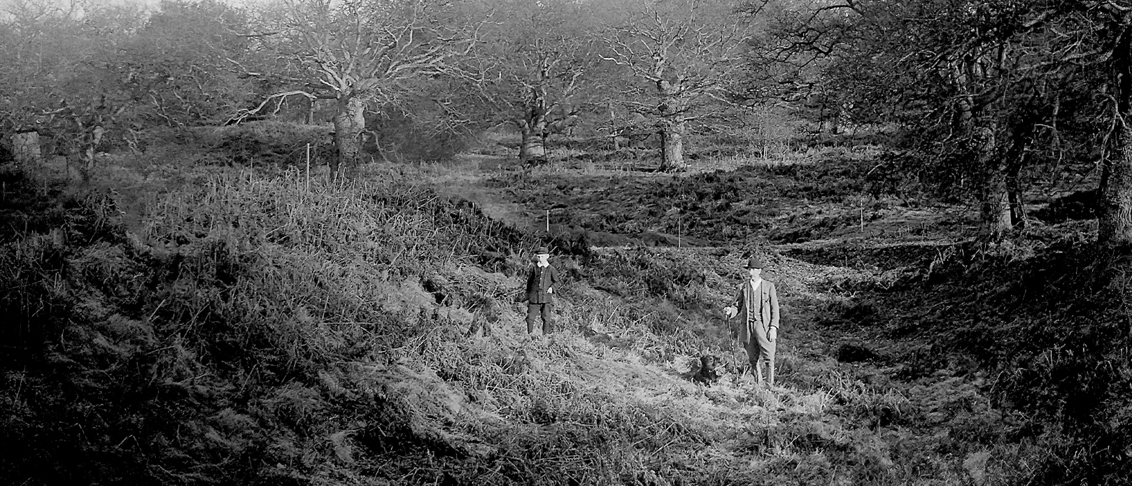
We are now finalising investigations for publication and end our research with an exploration of the enigmatic earthwork Cumberland’s Mount, for bizarrely there is no definitive consensus on exactly what it is. This vast horseshoe shaped earthwork 92 by 85 metres has various attributions, including it being the remains of a timber Castle called a ring work, a red hill – this being a by product of salt production created between the Iron Age to Roman period, or even that it might have been a temporary camp created by insurgents during the peasants revolt in 1381. Ritually planned landscapes used locations chosen for their mythological and cosmological functions, forming part of a wider ensouled landscape.
A winter solstice sunrise and summer solstice sunset alignment passes through the landscape at Staverton, an ancient oak woodland and royal deer park on the periphery of Raedwald’s kingdom. Raedwald was famously buried at Sutton Hoo, and his lavish royal hall at Rendlesham lay on the Northern boundary of the East Saxon territory in the 7th C.
Sitting on the edge of Staverton Park, Cumberland’s Mount was sited in marshland and partly submerged by water for half of the year. It would have been approached from Friday Street, an ancient green road that we believe was once a processional routeway.
Along with Burrow Hill at the mouth of the Butley River, also a marshland location and originally an island site, these sites echoed notions of a pre-Christian Nordic cosmos, where a tree, world pillar or post was surrounded by water.
Solar Sandlings Walk
To celebrate the culmination of our research into Staverton and the ancient surrounding ritual landscape, we have created a special walking route that embraces the underlying concepts and sites that we present within this work. Full details of this route, including downloadable maps and an overview of the sites are available on the excellent British Pilgrimage Trust website. We would like to extend our thanks to the British Pilgrimage Trust for their inspiring work and interest in our research.
Footnotes
* Unless stated otherwise or unless quoting from source material, all other dates used from here will be A.D.
** An English monk (673-735) Saint Bede or the Venerable Bede was also an author and scholar often referred to as the father of English history.
*** In the section, ‘The people of the Suffolk Sandlings: royal rule, kingdom and beliefs’, I will explore why this term currently is often challenged.
References
- Rackham, O (1986) The History of the Countryside: The Classic History of Britain’s landscape, flora and fauna
- Williamson, T (2005) Sandlands: The Suffolk Coast and Heaths. Windgather Press. Macclesfield
- Rackham, O (1986) The History of the Countryside: The Classic History of Britain’s landscape, flora and fauna. Phoenix Press. London
- Peterken, G.F (1969) Development of Vegetation in Staverton Park, Suffolk. Field Studies 3.
- Battell, G., Hoppitt, R. & Martin, E., (2007) ‘Staverton Park’, Proceedings of the Suffolk Institute of Archaeology and History vol. XLI pt. 3.
- Darby, H.C (1952) The Domesday geography of Eastern England. C.U.P. Cambridge
- Peterken, G.F (1969) (Ibid)
- Williamson, T (2005) (Ibid)
- Clarke, R.R (1960) East Anglia. Thames & Hudson. London
- Bruce-Mitford, R. L. S (1948) Saxon Rendlesham: Some preliminary considerations. Proceedings of the Suffolk Institute of Archaeology. Ipswich. XXIV (3)
- Anglo-Saxon Palace at Rendlesham (2016) University of Suffolk
- Rackham, O (2006) Woodlands. Harper Collins. London
- Heathland Restoration in the Suffolk Sandlings. Environmental Statement for Suffolk Coastal District Council. The Landscape Partnership. (2012)
- Beardall, C & Casey, D (1995) Suffolk’s Changing Countryside. Wildlife habitats and their conservation in Suffolk. Suffolk Wildlife Trust.
- Peterken, G.F (1969) (Ibid)
- Briggs, K (2015) Suffolk place-names: elements and personal names.
- Taylor, J & Taylor, M (2019) A Ritual Landscape Considered: Cosmography and Anglo Saxon ship burials.