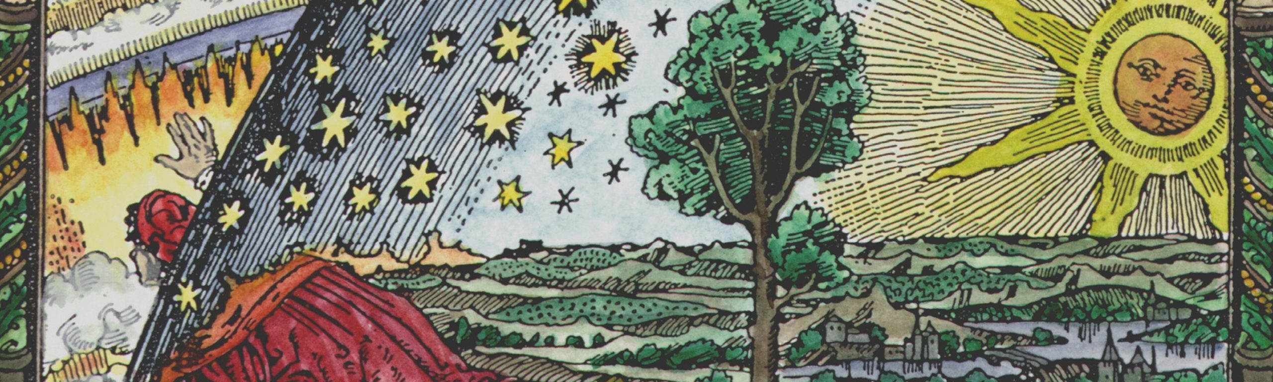
A Vision of an Arcane Landscape
It seems an awfully long time ago now, but I began exploring Suffolk’s ancient ritual landscape in the mid 1980s, leading to a decade of research and deeper exploration from the late 90s onwards. It culminated in the 2008 publication of ‘Seven Wonders – Suffolk’s Ancient Sites: A Vision of an Arcane Landscape’, then later updated with additional archaeological references.
Over those years in the run up to 2006 when my writing concluded a couple of years prior to publication, my research began to feel increasingly like science fiction, as my investigations led me towards a series of interrelated ancient sites covering a vast circle in the form of what looked like a heptagon.
By way of background, I grew up in and around Bury St Edmunds, aware that this sacred town was linked to the beheaded king, St Edmund. Martyred in 869, his shrine was moved to the crypt on the site of the present-day abbey ruins around 903, and the monastery was formally founded in 1020. I also knew that the town and its great abbey shared monastic similarities with Glastonbury, another sacred landscape in the south-west. Growing up, everything ‘other’ and enigmatic seemed to belong to the south-west: Stonehenge, Avebury, Maiden Castle, Glastonbury Tor, Silbury Hill, the Marlborough Mound, and so on. Learning about the Fornham Cursus and the ‘hengiform’ [1] monuments at Bury St Edmunds marked a significant turning point in my understanding. The cursus, 1.87 km long, snakes towards Bury Abbey. Positioned precisely at its terminus were four circular ring ditches, each spanning 30–50 metres across; these ‘hengiform’ monuments became known as the Bury henge. [2] This is set within what has been described as a “major prehistoric ritual landscape” along the River Lark Valley [3], considered “as significant as Stonehenge” by Dr McAndrew, archaeologist specialising in prehistoric landscapes. [4]
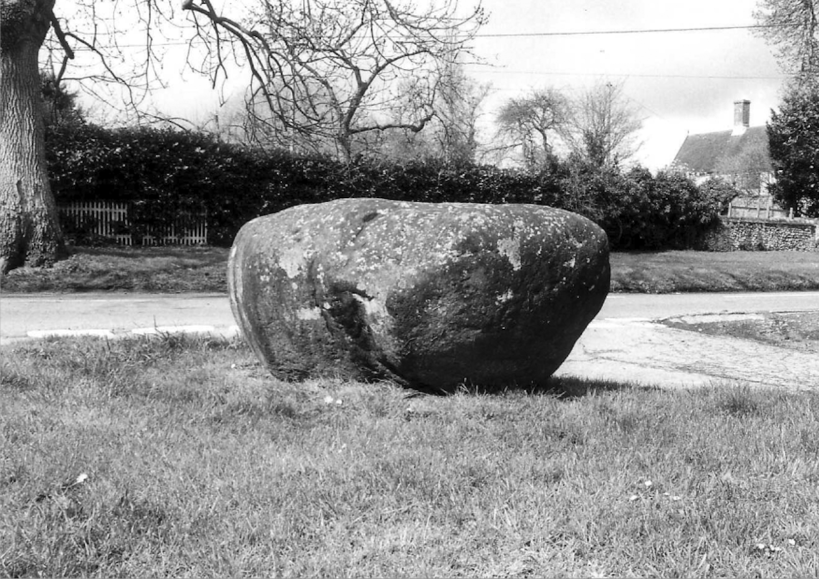
I was aware that Bury St Edmunds and Glastonbury shared another landscape parallel; both were reported to have a terrestrial zodiac, a vast map interpreted as zodiacal constellations formed from natural and man-made features. Although often rightly dismissed as pseudoscience, certain aspects proved particularly compelling. First, even John Dee, (1527–1608) mathematician, astronomer, astrologer, and scientific adviser to Queen Elizabeth, reported on the Glastonbury landscape, stating that “the stars that correspond to their representations on the ground… and astronomy are carefully and exactly united and measured in a scientific reconstruction of the heavens, showing that the ancients understood everything that today the learned know to be facts”. [5] Moreover, the Hartest Stone, a huge ovoid granite boulder located in the village where I lived at the time, measuring roughly 4 × 4 × 3 feet, was said to mark the centre of this terrestrial zodiac. Situated in Suffolk’s highest village, the Hartest Stone was reportedly dragged from the ancient woodland at Hawk’s Leys in Rede to its current location. [6] Additionally, I had the pleasure of viewing the Bury Bible when it was temporarily displayed in the then Manor House Museum. Recorded in the Gesta Sacristarum of Bury St Edmunds Abbey, it was commissioned by Sacrist Hervey (1125–38) and illuminated by Master Hugo, a secular artist of great renown. Having required around 350 calfskins and over two years to complete[7] its surviving six full-page Romanesque illustrations with Byzantine influences remain incredibly vibrant and technically masterful today. The first page features an illuminated letter ‘F’, nearly two feet high, introducing Jerome’s prologue. It is in this splendidly illustrated character at the top left-hand corner, the point which naturally guides one’s eye into this great majestic volume, that one is confronted with the symbol of the centaur – Sagittarius. Out of all the noble Christian iconic imagery that Master Hugo could have used I find the use of this pagan mythological and astrological figure intriguing, if not a deliberate act. Its inclusion I felt at the time reflected the insight of the initiated Master Hugo into the figure’s geomantic significance for the town of Bury St Edmunds, which reportedly sits in the constellation of Sagittarius. [8]
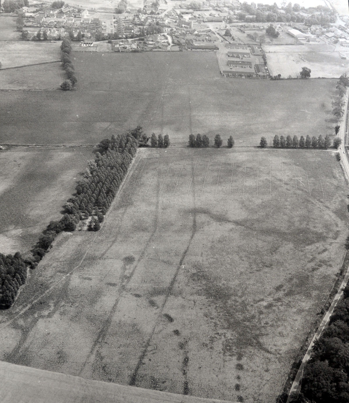
I became intrigued by an ancient woodland located due north of Bury St Edmunds, containing the Seven Hills group of tumuli, in the parish of Little Livermere. Of the seven original barrows, only three and one ring ditch remain within a small fir copse north of Bury St Edmunds, within a gently undulating region, situated just east of the Icknield Way path. In the mid-1800s, one mound measured up to 25 metres wide and over 2 metres high, though they have since diminished due to natural processes and human-induced degradation. The three bowl barrows are believed to date from the late Neolithic period (2400–1500 BC) and may have been associated with funerary practices. However, subsequent research revealed that these monuments were far from being solely for burial, a survey of 350 barrows in Wiltshire found that 35% contained no skeletons, artefacts, or cremated remains. [9] Many round barrows symbolically “represent the wider landscape in architectural form” [10] and were believed to embody the centre of the world, or even the cosmos. [11] Such monuments were intentionally designed to shape human experience of the landscape and to structure perceptions of both space and time. [12] The Seven Hills tumuli group is located at what may be the only site in Suffolk where all three ancestral trackways – the Icknield Way, Peddars Way, and Puddingstone Track – converge. I found a map in the Records Office, dated 1629 by Thomas Waterman, which clearly showed the ‘Peddars Waye’ running east to west through the centre of the woodland at Seven Hills (then recorded as ‘Ampton Heath’). In my mind at the time, this was the only location in Suffolk where all three ancient trackways united.
Three main factors finally motivated me to write what became ‘Seven Wonders’:
1. Sir Norman Lockyer (1836–1920), an English astronomer and scientist, founder of the journal Nature in 1869, and the first professor of astronomical physics at the Royal College of Science in the early 1900’s had also studied ancient site alignments over vast distances. He discovered an equilateral triangle whose three points (Stonehenge, Grovely Castle hill fort and Old Sarum hill fort) were all exactly 9.6 kilometres from each other [13] and concluded the “alignments of these ancient sites are not accidental; they reveal a deliberate geometrical plan, for Stonehenge, Grovely Castle, and Old Sarum form an equilateral triangle, each side measuring about six miles. Such precision suggests that the builders possessed both astronomical knowledge and a sense of order extending beyond mere utility.”
2. In ‘The Landscape Geometry of Southern Britain’, [14] of all the geomantic features Behrend discovered and mapped across the landscape, the most common formations he discovered were decagons and heptagons, all created with an incredible error of margin of only 1 in 7,000. It was pertinent that Behrend stated that terrestrial zodiacs were nearly always “sited in the neighbourhood of a heptagon vertex.” [15]
3. In Furlong’s ‘The Keys to the Temple’, he proposed that the ancient sites across the Marlborough Downs in Wiltshire were arranged in two large concentric circles.[16] These circles, according to his analysis, were based on a geometric framework where the radius and spacing between key points often relate to a 9.6-kilometre unit. The size of the circular area of sites I had been investigating, centring on Bury St Edmunds, turned out to be almost identical in size, in my case the radius. Remarkably, my calculation was only a few metres off.
Looking back with fresh eyes and all that I have since learned, would I change aspects of ‘Seven Wonders’? Most definitely. It was largely written in the years before 2006, and I doubt anyone revisits something they produced that long ago without a certain sense of trepidation. I was heartened however, by a 2014 Amazon review which concluded that the seven primary locations I had investigated concluded that they were “aligned to seven ancient sites, each with their own corresponding features and characteristics; the placements are absolutely accurate (I’ve checked on Google Earth).” My research was conducted in a time before Google Earth existed, when my only option was to commission a private satellite mapping company in 2004 to verify my findings by providing highly accurate coordinates for me.
In the years following publication, our vision of Suffolk’s arcane landscape matured into the Arcane Landscape Trust. As a not-for-profit volunteer-led charity, our pursuit of advancing knowledge, understanding, and appreciation of historic British Ritual Landscapes has become even more rigorous, and we still aim to present new perspectives that draw on multidisciplinary research, including archaeology, archaeoastronomy, mythological narratives, traditions, and folklore. As we do so, we strive to learn from the dialogue between past and present, viewing these landscapes not as static relics but as living cultural frameworks. Our work fosters engagement, critical inquiry, and a renewed connection with sacred geography, enriching understanding of our cultural heritage.
Download > Seven Wonders – Suffolk’s Ancient Sites: A Vision of an Arcane Landscape
*Footnote. I am aware that more recently, the validity of Rudge’s research and conclusions regarding the Puddingstone Track have been brought into question. Burgess in 2020 concluded his detailed study, ‘The Puddingstone Track: Deconstructed’ which highlights the myriad of discrepancies and confirmation bias levied by Rudge, which included ignoring stones that did not fit his track or ‘theory’ as well as the attribution of the ‘track’ to the Tardenoisian culture, which was based on rather flawed chronologies of the 1920-30’s. Burgess, M. (2020) The Puddingstone Track: Deconstructed.
REFERENCES
1. Martin, E. A. (1981). When is a henge not a henge? Windmill mounds and hengiform structures. Proc Suffolk Inst Archaeol Hist 35. Vol 35
2. Martin, E.A. (1982) When is a Henge Not a Henge?, in Suffolk Institute of Archaeology and History, Vol. 35. Part 2.
3. Ghaemi, M. (2014) Suffolk/Fornham All Saints: County could have an ‘equivalent to Stonehenge’. East Anglian Daily Times, 3 February.
4. Ghaemi, M. (2014) Ibid
5. Deacon, R. (1968) John Dee: Scientist, Geographer, Astrologer and Secret Agent to Elizabeth I. London: Frederick Muller.
6. Toulson, S. (1979) East Anglia: Walking the Ley Lines and Ancient Tracks, London, Wildwood House.
7. Whittaker, A. (2002) The Good Book, in The Suffolk Journal, no: 94, Dec. 2002
8. Burgess, M. (1979) The Bury St. Edmunds Terrestrial Zodiac, East Suffolk and Norfolk Antiquarians, Anglian Research Papers, No. 1, Lowestoft.
9. Furlong, D. (1997) The Keys to the Temple, Piatkus, London.
10. Watson, A. (2001) Round barrows in a circular world : monumentalising landscapes in early Bronze age Wessex, in Bruick. J. (Eds) Bronze Age Landscapes: Tradition and Transformation, Oxbow Books, Oxford.
11. Richards, C. (1996) Monuments as Landscape: Creating the centre of the world in late Neolithic Orkney,
World Archaeology, 28,
12. Watson, A. (2001) Ibid
13. Lockyer, J.N. (1909) Stonehenge and Other British Stone Monuments Astronomically Considered. London: Macmillan.
14. Behrend, M. (1975) The Landscape Geometry of Southern Britain, The Institute of Geomantic Research – Occasional paper 1, Bar Hill
15. Behrend, M. (1975) Ibid
16. Furlong, D. (1997) Ibid