Solar Sandlings Walk
To celebrate the culmination of our research into Staverton and the ancient surrounding ritual landscape, we have created a special ‘Solar Sandlings’ walking route that embraces the underlying concepts and sites that we present within this work.
Full details of this route, including downloadable maps and an overview of the sites are available on the excellent British Pilgrimage Trust website. We would like to extend our thanks to the British Pilgrimage Trust for their inspiring work and interest in our research.
The area known as the Suffolk Sandlings plays host to some of Britain’s rarest wildlife habitat, and home to a deep history and heritage.
Our 7 mile route is focused on a series of distinct ancient sites proposed by Arcane Landscape Trust researcher Jeremy Taylor, whose work explores how this ritually planned landscape is integrated within systematic sites that were orientated around celestial events. Jeremy’s initial scene setting research on this captivating landscape is available in our ‘Staverton – Wonderland of Kings – Pt 1’ publication. ‘Pt 2 – Landscapes & Skyscapes’ (forthcoming) highlights how three distinct and ancient sites from the late antique – early medieval period fit within the wider ritual landscape and are all integrated within a designed environment that is oriented around primary and mythological celestial events.
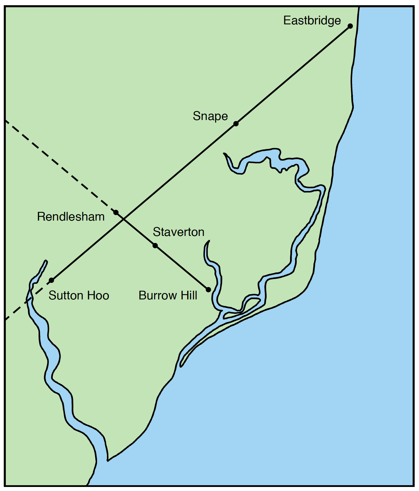
The key locations are positioned on a solar alignment that targets the winter solstice sunrise / summer solstice sunset axis, crossing a larger summer solstice sunrise / winter solstice sunset alignment between the only two known intact ship burials discovered in England. This ‘cross’ in the landscape reflects a profound sacred symbol and tradition, one that repeatedly features in spiritual iconography as well as being fundamental to the construction of ordained ritual landscapes, designed to marry the primary solstitial and cardinal points across the land with the heavens.
This enchanting and eerily evocative landscape invites us to re-evaluate our understanding of the sites relationship with the more widely known sacred settings of the surrounding Wuffing kingdom in nearby Sutton Hoo, Snape, and Rendlesham, our starting point and home to King Raedwald’s Royal Palace and cult centre.
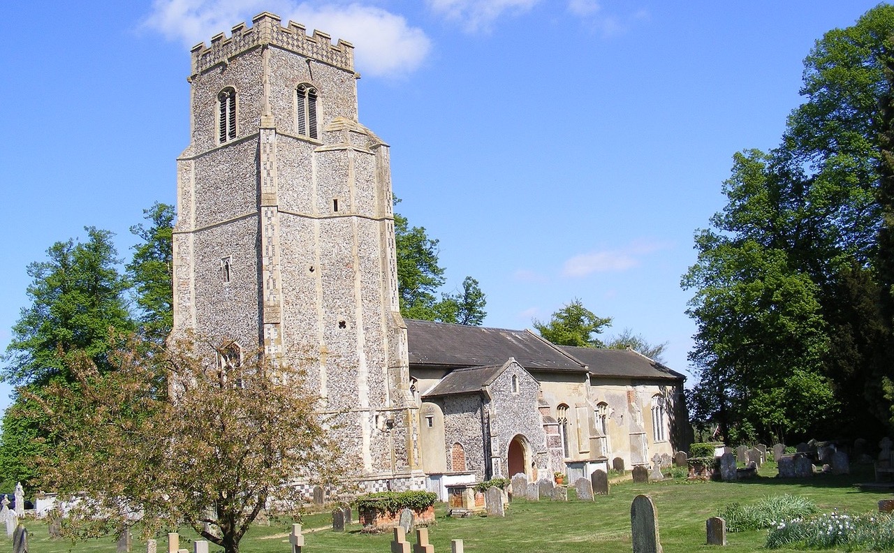
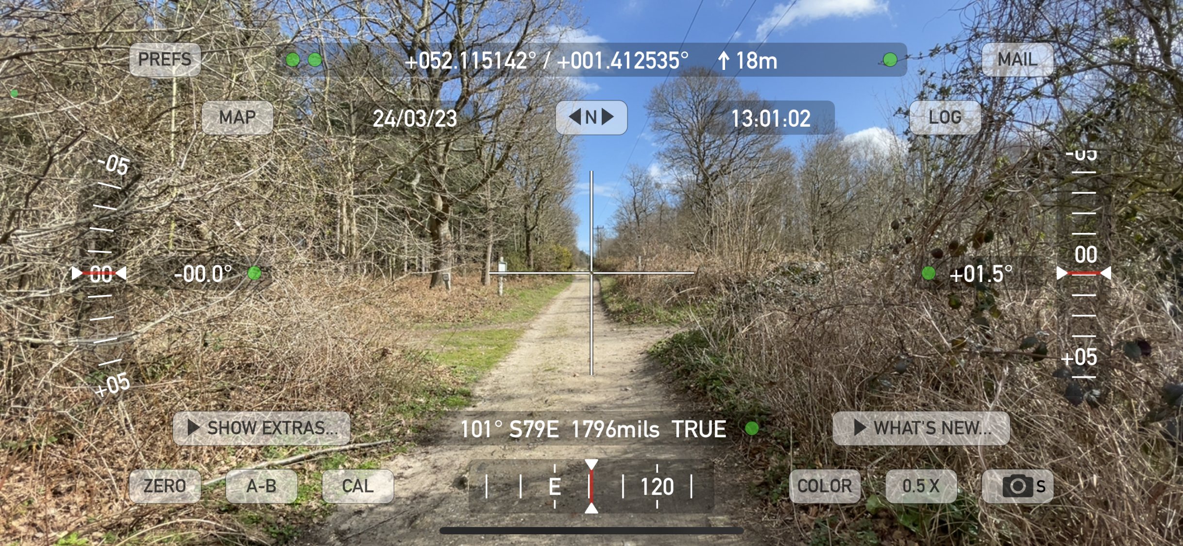
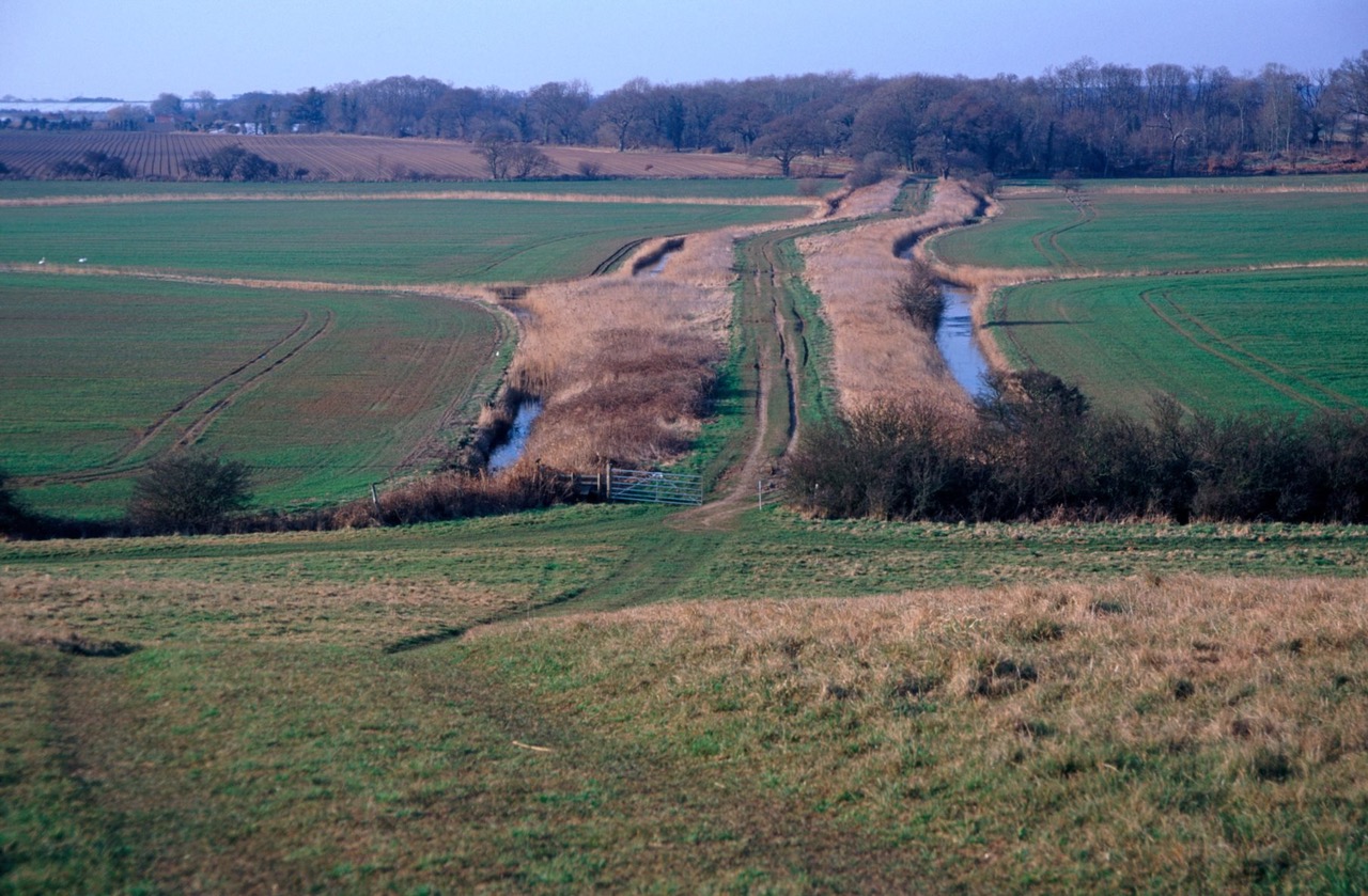
The walk from St. Gregory’s Church in Rendlesham towards Staverton Park, and beyond to Burrow Hill navigates an ancient green lane through the hamlet of Friday Street. This track runs adjacent to the parish boundary and has a procession-like quality leading towards the enigmatic Cumberland’s Mount, a half-moon shaped earthwork of significant magnitude housed within the privately owned Staverton Park.
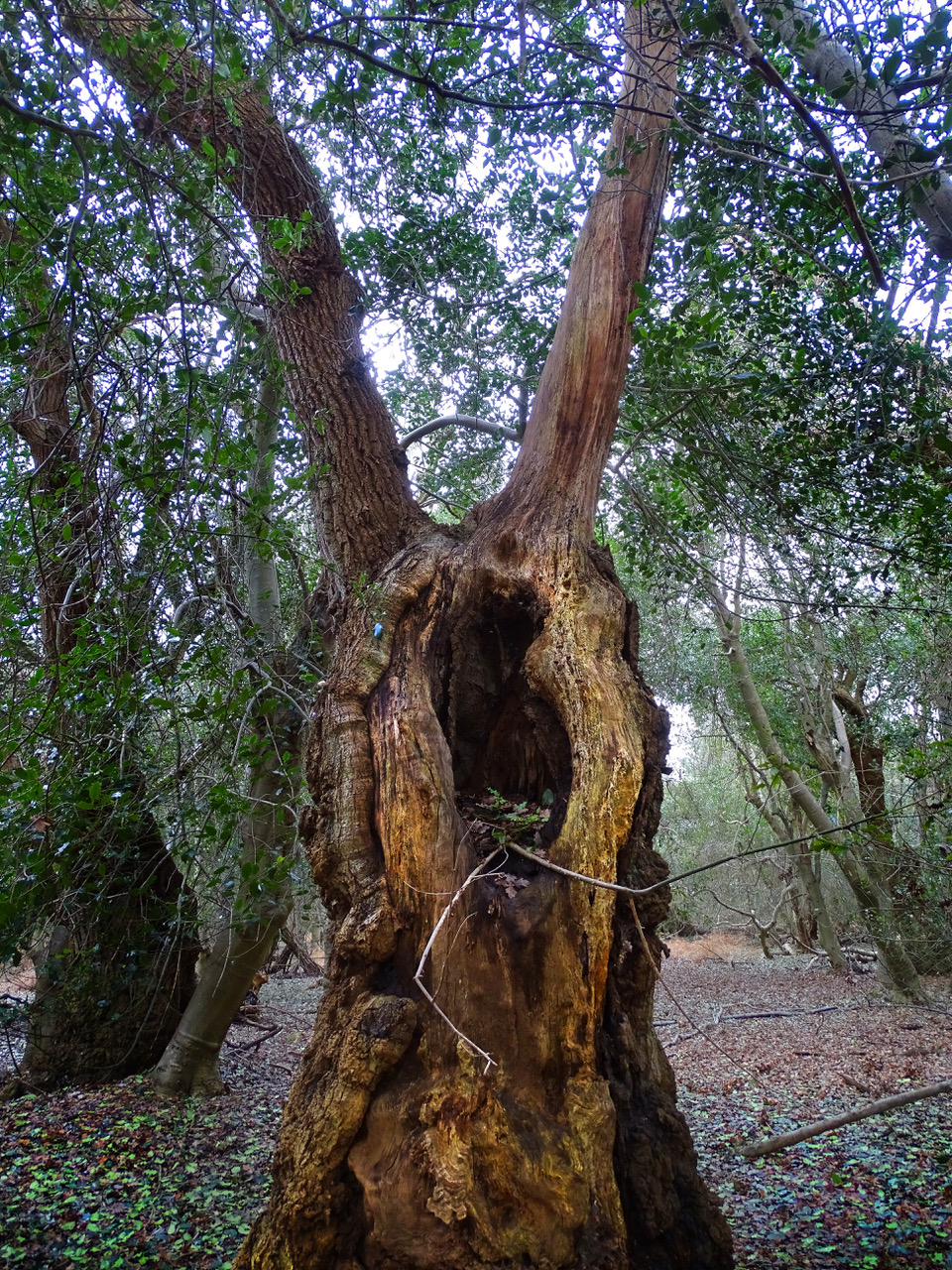
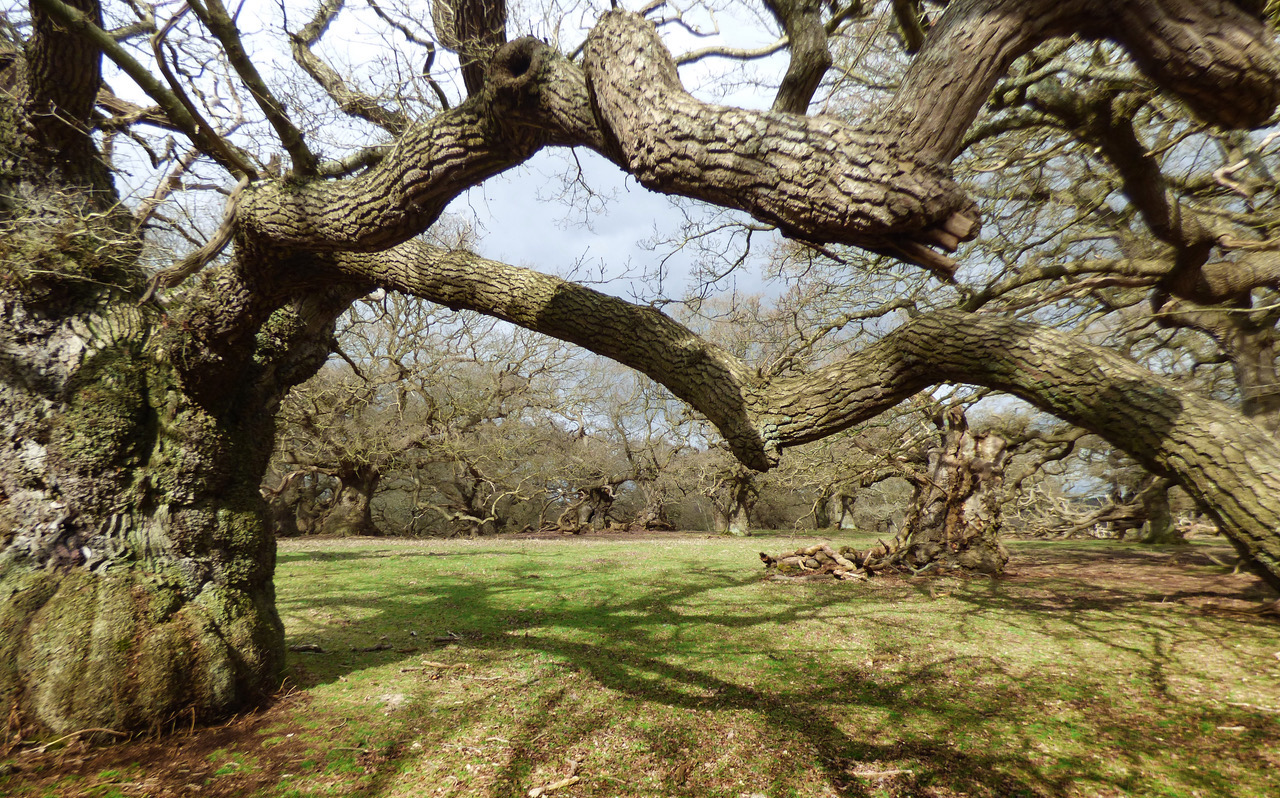
tree that has since regenerated.
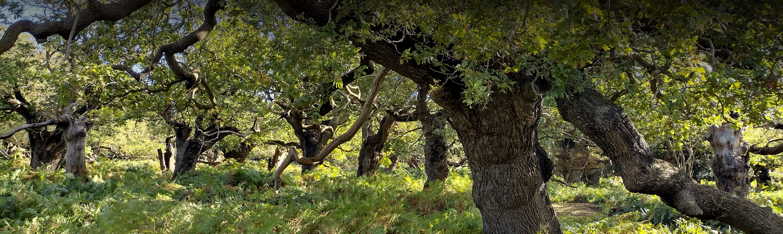
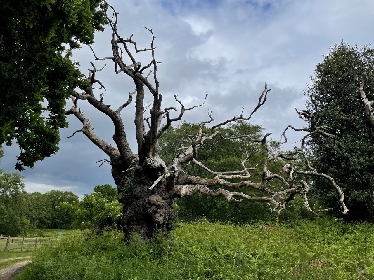
Although the route circumnavigates the park, it is the walks mesmerising centrepiece affording stunning views of this most primordial of forests. Few places on earth touch the soul as deeply as Staverton, be this the mighty contorted oaks in the park itself, home to one of the largest collections of ancient trees in the whole of Europe, or the overwhelming density of the trees in the publicly accessible area known as The Thicks, many of which have regenerated as aptly named ‘phoenix’ trees.
Our walk then gently snakes toward the liminal Burrow Hill, overlooking the mouth of the Butley River via a long earthwork causeway known as The Thrift. Burrow Hill was originally an island minster site and occupied during the Iron Age and Roman times long before the Augustinian priory was founded on the hilltop in the late 12th Century. Due to its close proximity to Rendlesham it is considered a significant Wuffing site.
As well as the site yielding many runic coins, there was also the remains of what are called ‘pseudo-boat burials’, a type of log boat in the form of a bathtub or coffin boat, surrounding the deceased. The practice of placing clinker boat timbers, or substitute planks of boats to either line or cover a grave, mirrors the East Anglian boat-burial tradition found at Snape and Sutton Hoo with a much wider pan-Germanic concept.
This route can be started at either end, but we recommend a starting point of St. Gregory’s Church, Rendlesham, near Woodbridge IP12 2QY, where parking is favourable. Burrow Hill is a symbolic end point before turning around to return.
For route details and downloadable maps, please see the British Pilgrimage Trust website.